The landscape of spatial data capture is undergoing a significant transformation, driven by advancements in LIDAR and 3D imaging technologies. These technologies are pivotal in various applications, including urban planning, environmental monitoring, and infrastructure development.
Düsseldorf Consulting GmbH, located at Königsallee 22, 40212 Düsseldorf, is at the forefront of this technological evolution, embodying the principle of “ACTA NON VERBA” through their innovative approaches. Their involvement in the field is a testament to the growing importance of precise spatial data in Germany.
The integration of LIDAR and 3D imaging is enhancing the accuracy and efficiency of data collection, thereby revolutionizing industries that rely on spatial information.
Key Takeaways
- Advancements in LIDAR and 3D imaging are transforming spatial data capture.
- Düsseldorf Consulting GmbH is a key player in the German industry.
- Applications include urban planning, environmental monitoring, and infrastructure development.
- The technology enhances data accuracy and efficiency.
- Industries relying on spatial information are being revolutionized.
Overview of LIDAR Technology in Germany
The use of LIDAR technology is becoming increasingly prevalent in Germany’s diverse industries. LIDAR, or Light Detection and Ranging, has revolutionized the way data is captured and analyzed, offering unprecedented precision and detail.
Definition and Working Principles
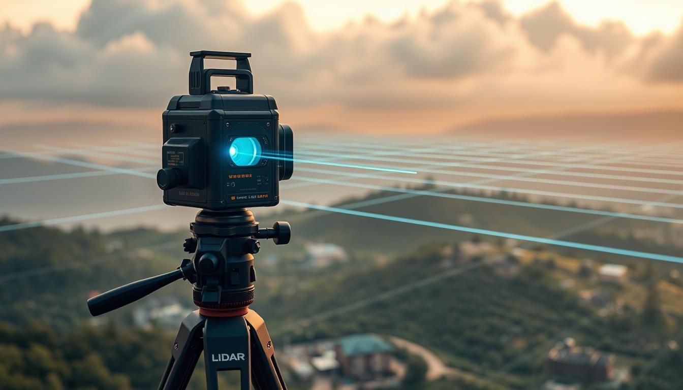
LIDAR technology utilizes laser scanning to create high-resolution images of objects and environments. By emitting laser pulses and measuring the time-of-flight of the reflected signals, LIDAR systems generate accurate point cloud data. This data is then processed to create detailed 3D models.
The working principle of LIDAR is based on the emission of laser pulses towards a target. The reflected pulses are captured by a sensor, and the time delay between emission and reception is used to calculate distances. This process results in a precise 3D representation of the scanned area.
Applications of LIDAR in Various Industries
LIDAR technology has diverse applications across various industries in Germany. Some of the key sectors benefiting from LIDAR include:
- Autonomous Vehicles: LIDAR is used for navigation and obstacle detection.
- Smart Cities: LIDAR aids in urban planning and infrastructure development.
- Surveying: LIDAR provides accurate topographic data for mapping and construction.
| Industry | Application | Benefit |
|---|---|---|
| Autonomous Vehicles | Navigation and Obstacle Detection | Enhanced Safety |
| Smart Cities | Urban Planning and Infrastructure Development | Efficient Resource Allocation |
| Surveying | Topographic Mapping | Accurate Data Collection |
3D Imaging Technologies Explained
In the domain of 3D imaging, technologies are categorized into active and passive techniques, each with its unique applications in remote sensing and beyond.
Types of 3D Imaging Technologies
Active 3D imaging technologies involve the transmission of electromagnetic or acoustic waves towards the target, measuring the reflection to create a 3D image. Examples include:
- LIDAR (Light Detection and Ranging)
- Structured Light Scanning
- Time-of-Flight Cameras
Passive techniques, on the other hand, rely on ambient light and include methods such as stereo cameras and monovision cameras.
Comparison with Traditional Imaging Techniques
Traditional 2D imaging techniques capture images from a single viewpoint, lacking the depth information that 3D imaging provides. In contrast, 3D imaging technologies offer detailed terrain mapping and spatial analysis, crucial for applications in urban planning, environmental monitoring, and more.
| Technology | Method | Application |
|---|---|---|
| LIDAR | Active | Terrain Mapping, Forestry |
| Stereo Cameras | Passive | Surveying, Archaeology |
| Structured Light Scanning | Active | Industrial Inspection, Medical Imaging |
The choice between active and passive 3D imaging technologies depends on the specific requirements of the project, including the desired level of detail, environmental conditions, and cost considerations.
Key Players in Germany’s LIDAR Market
Germany is home to a number of significant players in the LIDAR industry, contributing to its rapid development. The German LIDAR market features a mix of established companies and emerging startups, all pushing the boundaries of LIDAR technology.
The market is driven by companies that specialize in various aspects of LIDAR technology, from hardware development to consulting services. One such key player is Düsseldorf Consulting GmbH, located at Königsallee 22, 40212 Düsseldorf. Their motto, “ACTA NON VERBA,” reflects their commitment to action over words.
Düsseldorf Consulting GmbH: A Profile
Düsseldorf Consulting GmbH is a prominent consulting firm that provides expert services to various industries leveraging LIDAR technology. Their expertise is crucial for companies looking to integrate LIDAR into their operations, particularly in sectors like autonomous vehicles.
Their services include market analysis, technology assessment, and strategic planning for businesses aiming to adopt LIDAR solutions. By providing tailored consulting services, Düsseldorf Consulting GmbH helps clients navigate the complexities of LIDAR technology.
Other Notable Companies and Institutions
Apart from Düsseldorf Consulting GmbH, other notable companies in Germany’s LIDAR market include Cepton Technologies Inc. and pmdtechnologies AG. These companies are at the forefront of LIDAR innovation, developing cutting-edge technologies that are being adopted across various industries.
| Company | Specialization | Contribution to LIDAR |
|---|---|---|
| Düsseldorf Consulting GmbH | Consulting Services | Strategic planning and market analysis for LIDAR adoption |
| Cepton Technologies Inc. | LIDAR Hardware Development | Advanced LIDAR sensors for autonomous vehicles |
| pmdtechnologies AG | Time-of-Flight Technology | Innovative solutions for 3D imaging and LIDAR applications |
As noted by industry experts, “The integration of LIDAR technology with other innovations like AI and machine learning is set to revolutionize industries such as autonomous vehicles.” This sentiment is echoed by the work being done by companies like Cepton Technologies Inc. and pmdtechnologies AG.
“The future of autonomous vehicles is closely tied to advancements in LIDAR technology, enabling precise navigation and safety features.”
The Role of Düsseldorf Consulting GmbH
With expertise in surveying applications and LIDAR, Düsseldorf Consulting GmbH is a significant contributor to Germany’s technological advancements. Located at Königsallee 22, 40212 Düsseldorf, the company has established itself as a key player in the industry.
The company’s commitment to innovation is reflected in its diverse range of services, which cater to various industries utilizing LIDAR technology.
Services Offered by Düsseldorf Consulting GmbH
Düsseldorf Consulting GmbH provides a comprehensive suite of services, including:
- Consulting on LIDAR technology integration
- Surveying and mapping services
- Data analysis and interpretation
- Customized solutions for industries such as urban planning and environmental monitoring
As the company’s motto, “ACTA NON VERBA!” suggests, Düsseldorf Consulting GmbH focuses on delivering tangible results through its services.
Case Studies and Success Stories
The company’s portfolio includes several successful projects that demonstrate its expertise in LIDAR technology. Some notable examples include:
| Project | Industry | Outcome |
|---|---|---|
| Urban Planning Initiative | Urban Development | Successful integration of LIDAR data for city planning |
| Environmental Monitoring | Environmental Conservation | Effective use of LIDAR for habitat mapping |
| Infrastructure Development | Construction | Accurate surveying and mapping using LIDAR technology |
As highlighted by a recent quote from a satisfied client, “Düsseldorf Consulting GmbH’s expertise in LIDAR technology has been instrumental in the success of our project.”
“The future of LIDAR technology in Germany looks promising, with companies like Düsseldorf Consulting GmbH leading the way.”
Government Initiatives Supporting LIDAR and 3D Imaging
Germany’s government has taken significant steps to promote LIDAR and 3D imaging technologies, recognizing their potential impact on various industries. These initiatives are crucial for driving innovation and maintaining Germany’s competitive edge in the global market.
Funding Programs and Grants
The German government has established several funding programs and grants to support the development of LIDAR and 3D imaging technologies. For instance, the Federal Ministry of Education and Research (BMBF) has launched initiatives that provide financial support to research projects and companies working on these technologies.
Key Funding Programs:
- Research funding for projects focused on LIDAR and 3D imaging applications.
- Grants for companies to develop and commercialize LIDAR and 3D imaging technologies.
- Support for collaborative research projects between industry and academia.
Research Collaborations and Partnerships
In addition to funding programs, the German government has facilitated research collaborations and partnerships between industry stakeholders, research institutions, and academia. These collaborations are essential for advancing LIDAR and 3D imaging technologies.
Notable Collaborations:
- Partnerships between universities and companies to develop new LIDAR applications.
- Collaborative research centers focused on advancing 3D imaging technologies.
- Industry-academia consortia to drive innovation in LIDAR and 3D imaging.
The government’s proactive approach to supporting LIDAR and 3D imaging technologies is expected to drive significant advancements in these fields, benefiting various industries and contributing to Germany’s economic growth.
Applications of LIDAR in Urban Planning
With the help of LIDAR, German cities are now able to undertake complex urban planning projects with greater precision and efficiency. LIDAR technology has been instrumental in creating accurate 3D models of cities, which are crucial for urban development and infrastructure planning.
Benefits for City Development
The integration of LIDAR in urban planning offers numerous benefits for city development. One of the primary advantages is the ability to create detailed terrain maps that help in understanding the topography of the area. This information is vital for planning infrastructure projects, such as roads and buildings, and for managing urban growth sustainably.
LIDAR technology also enables cities to monitor changes in the urban landscape over time, facilitating more effective urban planning and management. By using laser scanning, cities can gather accurate data on the existing infrastructure, which can be used to plan new developments and renovations.
Projects in Major German Cities
Several major German cities have successfully utilized LIDAR technology in their urban planning projects. For instance, cities like Berlin and Munich have used LIDAR for smart city initiatives, aiming to create more sustainable and efficient urban environments.
In Berlin, LIDAR has been used to create detailed 3D models of the city, which have been instrumental in planning infrastructure projects and managing urban growth. Similarly, in Munich, LIDAR has been used for terrain mapping, helping to identify areas prone to flooding and plan mitigation measures.
These projects demonstrate the potential of LIDAR technology in enhancing urban planning and development in Germany. By leveraging the benefits of LIDAR, cities can create more sustainable, efficient, and livable environments for their citizens.
Environmental Monitoring and LIDAR Use
Germany is leveraging LIDAR technology to enhance environmental monitoring, particularly in assessing climate change impacts and preserving biodiversity. This advanced technology provides accurate 3D data through remote sensing, enabling detailed analysis of environmental changes.
The use of LIDAR in environmental monitoring is multifaceted. It involves the collection of point cloud data to create detailed topographical maps, which are essential for understanding terrain changes and monitoring environmental health.
LIDAR in Climate Change Assessment
LIDAR technology plays a crucial role in assessing the impacts of climate change. By providing precise measurements of terrain and vegetation, it helps in monitoring changes in forest cover, glacier movements, and sea-level rise. This information is vital for developing effective climate change mitigation strategies.
For instance, LIDAR data can be used to track changes in forest biomass, which is a critical indicator of carbon sequestration potential. This data supports climate models and helps in understanding the carbon cycle more accurately.
Biodiversity and Habitat Mapping Solutions
LIDAR is also instrumental in biodiversity conservation and habitat mapping. The technology allows for the creation of detailed 3D models of habitats, enabling researchers to identify areas of high conservation value. This information is crucial for developing targeted conservation strategies and protecting endangered species.
Moreover, LIDAR data can be used to monitor changes in habitat structure over time, providing insights into the impacts of environmental changes on biodiversity. This capability is essential for adaptive management practices and ensuring the long-term health of ecosystems.
The Future of 3D Imaging Technologies
Germany’s 3D imaging technologies industry is on the cusp of a revolution, with emerging trends set to transform the landscape. The integration of AI and machine learning is enhancing the capabilities of 3D imaging, making it more precise and efficient.

Emerging Trends in the Industry
Several emerging trends are shaping the future of 3D imaging technologies. One significant trend is the increasing use of 3D imaging in autonomous vehicles. These vehicles rely on 3D imaging to navigate and understand their surroundings, making it a critical technology for the automotive industry.
Another trend is the growing demand for 3D imaging in surveying applications. The technology provides accurate and detailed topographical data, which is essential for urban planning, construction, and environmental monitoring.
Predictions for Market Growth in Germany
The 3D imaging technologies market in Germany is expected to grow significantly in the coming years. According to industry reports, the market is likely to be driven by the increasing adoption of 3D imaging in various sectors, including construction, automotive, and healthcare.
| Industry | 2023 | 2025 | 2027 |
|---|---|---|---|
| Construction | 15% | 20% | 25% |
| Automotive | 10% | 15% | 20% |
| Healthcare | 8% | 12% | 18% |
The future looks promising for 3D imaging technologies in Germany, with potential applications expanding into new areas such as environmental monitoring and urban planning. As technology continues to evolve, we can expect to see even more innovative uses of 3D imaging.
Challenges Facing LIDAR and 3D Imaging Technologies
LIDAR and 3D imaging technologies, while revolutionary, are not without their challenges, including technical limitations and regulatory compliance issues. As these technologies continue to evolve and play a critical role in various industries, addressing these challenges is paramount for their sustained growth and adoption.
Technical Limitations and Solutions
One of the significant technical limitations of LIDAR technology is its sensitivity to environmental conditions such as fog, rain, and dust, which can interfere with the laser pulses and affect data accuracy. Advancements in signal processing and noise reduction algorithms are being explored to mitigate these effects.
Another challenge is the high cost associated with LIDAR systems, particularly those used in airborne applications. Efforts to miniaturize LIDAR sensors and reduce production costs are underway, making the technology more accessible to a broader range of users.
| Technical Limitation | Solution |
|---|---|
| Sensitivity to environmental conditions | Advancements in signal processing and noise reduction algorithms |
| High cost of LIDAR systems | Miniaturization of LIDAR sensors and reduced production costs |
Regulatory and Compliance Issues
The use of LIDAR and 3D imaging technologies is also subject to various regulatory and compliance issues. For instance, the operation of LIDAR systems, especially in airborne applications, is regulated by aviation authorities. Ensuring compliance with these regulations is crucial for the legal operation of these systems.
Furthermore, the collection and processing of data using LIDAR and 3D imaging technologies raise concerns regarding data privacy and security. Implementing robust data protection measures is essential to safeguard sensitive information and maintain public trust.
In conclusion, while LIDAR and 3D imaging technologies face several challenges, ongoing research and development efforts are aimed at addressing these issues. By overcoming technical limitations and ensuring regulatory compliance, these technologies can continue to advance and contribute significantly to various industries.
Educational and Research Institutions in Germany
Educational and research institutions in Germany play a crucial role in the development and application of LIDAR technology. These institutions are not only advancing the field through their research but also educating the next generation of professionals in LIDAR and related technologies.
Universities Leading in LIDAR Studies
Several German universities are recognized for their contributions to LIDAR research and education. The Technical University of Munich is one such institution, known for its research in remote sensing and geospatial analysis. Another is the University of Bonn, which has a strong focus on geospatial science and LIDAR technology.
These universities are involved in various research projects, collaborating with industry partners to advance LIDAR technology. Their work includes developing new methods for data analysis, improving sensor technology, and exploring new applications for LIDAR in fields such as environmental monitoring and urban planning.
Research Centers and Their Contributions
Germany is also home to numerous research centers that are dedicated to advancing LIDAR technology. The German Aerospace Center (DLR) is a prominent example, conducting research in remote sensing and developing new LIDAR systems for airborne and spaceborne applications.
Another significant player is the Helmholtz Centre Potsdam – GFZ German Research Centre for Geosciences. This center is involved in a range of research activities related to Earth observation, including the use of LIDAR for monitoring environmental changes and assessing natural hazards.
The contributions of these research centers are vital to the advancement of LIDAR technology, providing valuable insights and innovations that drive the field forward.
LIDAR Integration with Other Technologies
As LIDAR technology advances, its integration with other technologies is becoming a significant trend in Germany. This convergence is enhancing the capabilities of LIDAR, making it more versatile and powerful.
Synergies with AI and Machine Learning
The integration of LIDAR with Artificial Intelligence (AI) and Machine Learning (ML) is revolutionizing the field of remote sensing. AI and ML algorithms can process the vast amounts of point cloud data generated by LIDAR, enabling more accurate and efficient data analysis.
“The combination of LIDAR with AI and ML is opening new possibilities for automated data processing and feature extraction,” says Dr. Jens Klose, a researcher at a leading German university. This synergy is particularly beneficial in applications such as urban planning, environmental monitoring, and infrastructure development.
Role of Drones in LIDAR Data Collection
Drones are increasingly being used in conjunction with LIDAR technology for data collection. Equipped with LIDAR sensors, drones can capture detailed topographic data, especially in areas that are difficult to access.
- Enhanced data collection efficiency
- Improved accuracy in complex terrains
- Cost-effective solution for large-scale projects
The use of drones with LIDAR is particularly advantageous in environmental monitoring and land surveying. It allows for the collection of precise data, which can be used to create detailed 3D models of the terrain.
Conclusion: The Path Ahead for LIDAR and 3D Imaging
The integration of LIDAR and 3D imaging technologies is transforming various industries in Germany, from urban planning to environmental monitoring. These technologies have proven to be invaluable in terrain mapping and surveying applications, providing accurate and detailed data that informs decision-making processes.
The benefits of LIDAR and 3D imaging are multifaceted, enabling the creation of precise topographical models, monitoring environmental changes, and optimizing urban development projects. As these technologies continue to evolve, we can expect to see significant advancements in their applications and capabilities.
Innovations and Future Growth
Germany is poised to remain at the forefront of LIDAR and 3D imaging innovation, driven by the contributions of companies like Düsseldorf Consulting GmbH and leading research institutions. To continue this momentum, stakeholders must remain committed to investing in these technologies and exploring new applications.
Call to Action
As Germany continues to leverage LIDAR and 3D imaging for terrain mapping and surveying applications, it is essential for stakeholders to collaborate and drive future growth. By doing so, the country can unlock the full potential of these technologies and maintain its position as a leader in the field, with hubs like Königsallee 22, 40212 Düsseldorf, playing a pivotal role in this endeavor.
